

 ← Back to All Projects
Modernizing Saudi Energy’s GIS with ArcGIS Utility Network
Khatib & Alami (K&A) supported Saudi Energy (SE) with its ArcGIS Utility Network migration, moving electricity network data for 25 cities from the existing Geometric Network. The project also upgraded the GIS/ArcFM platform and K&A’s custom applications to support network records, editing workflows and information sharing across electricity operations, engineering and planning.
The project migrated electricity databases for 25 cities from the existing Geometric Network to Esri’s ArcGIS Utility Network. It also upgraded the GIS/ArcFM platform and K&A’s custom applications to work with the Utility Network.
Preparing GIS data for migration
Work began in October 2023 with an assessment of SE’s GIS data and a strategic roadmap for the migration. The team developed and deployed quality assurance and quality control tools to identify issues for SE’s data team to address.
Workshops with GIS users and SE engineers helped adapt Esri’s standard Utility Network data model to SE’s business requirements, including integration with ArcFM XI suites, SAP and the Distribution Management System (DMS).
Orientation seminars, workshops and GIS training prepared SE’s core team to work with the new platform.
Migrating to ArcGIS Utility Network and ArcFM XI
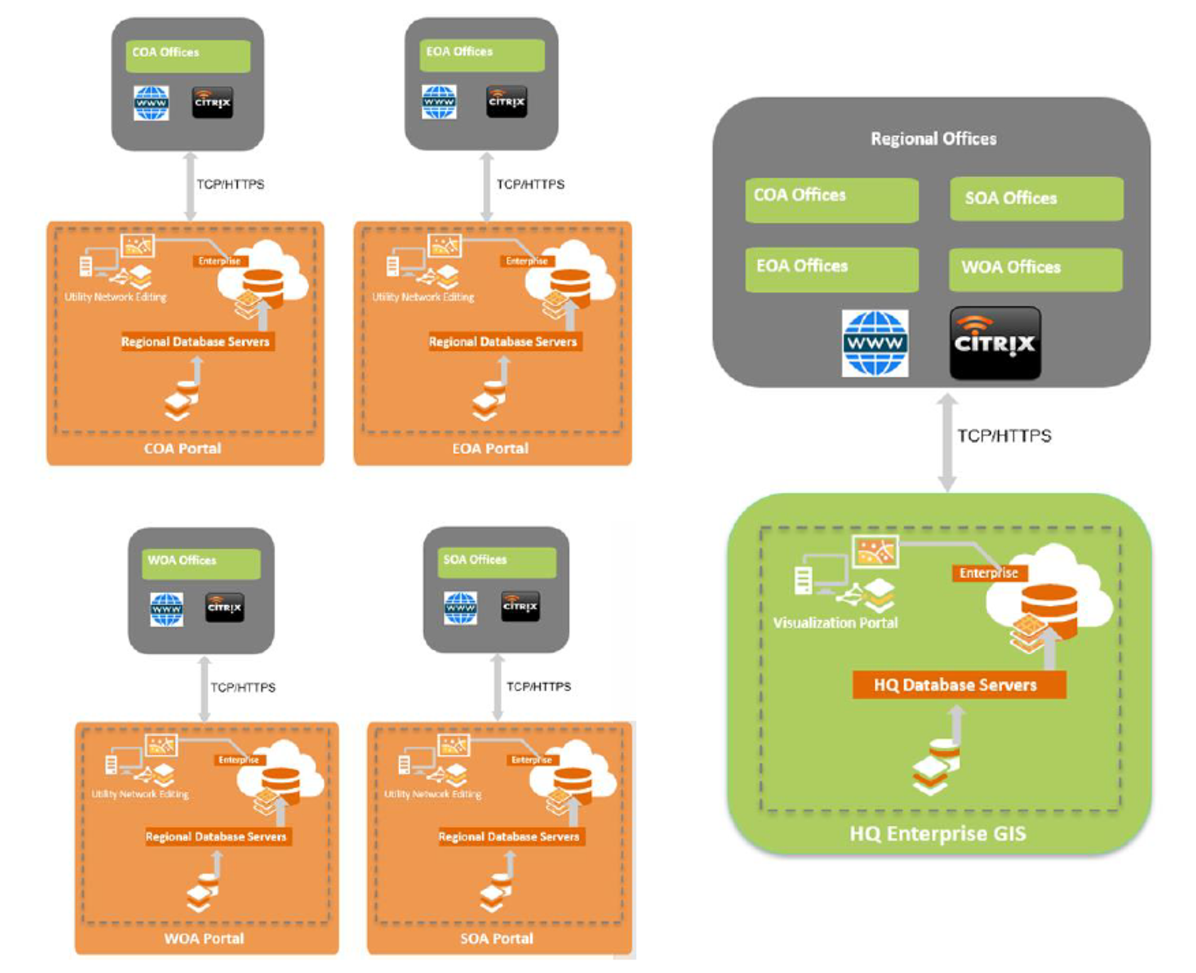 In July 2024, nine months after the project began, electricity network data for all 25 cities was successfully migrated into the customized Utility Network asset package using Esri’s standard migration tools.
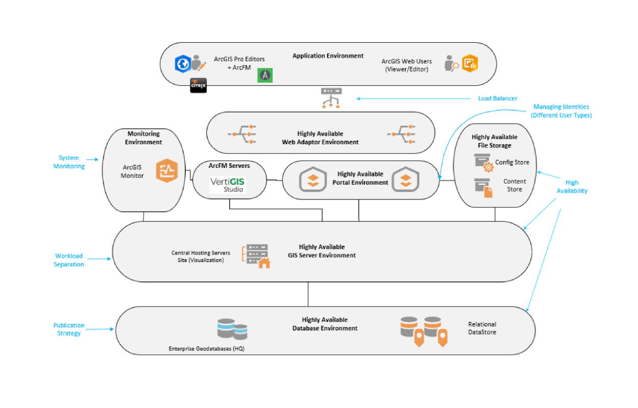
The work included an ArcGIS Enterprise upgrade with a new architecture and Portal for ArcGIS, alongside the implementation of ArcFM XI Editor and web components.
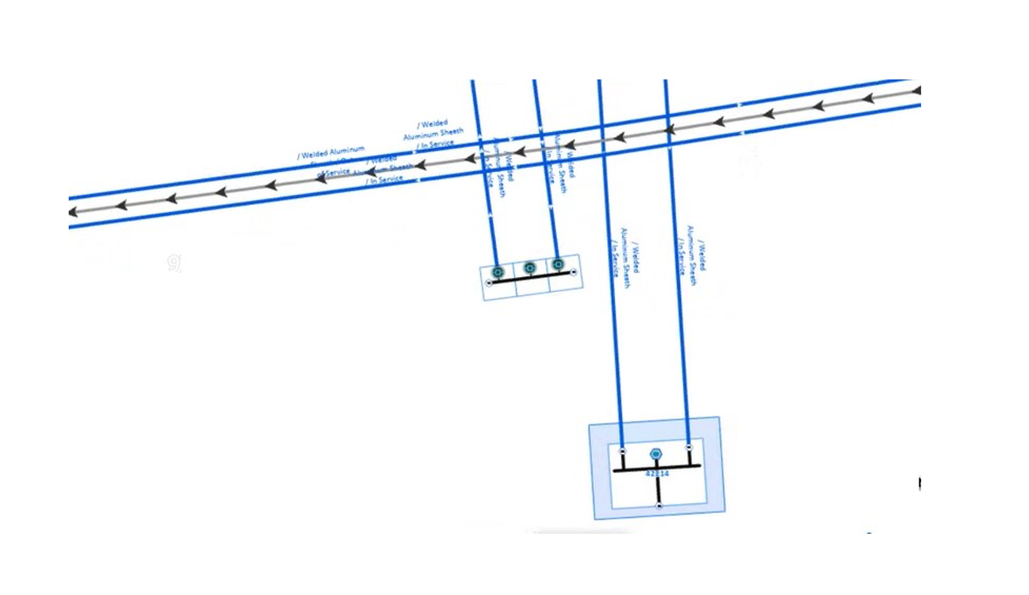
ArcFM Session Manager XI improved editing workflows. Cleaner datasets and enhanced quality control tools strengthened the records, while the customized data model allowed SE to capture finer network details. The upgraded enterprise platform also made GIS content easier to share.
Supporting electricity network planning
The team upgraded Eaton’s CYME software and introduced CYMDIST so SE’s engineers could model the distribution network and run simulations when planning its development.
A gateway transfers GIS data into CYME, making the network records available for these analyses.
The work also included SAP integration and connections with operational systems, including the Advanced Distribution Management System (ADMS). The team developed digital twin and artificial intelligence proofs of concept as part of the assignment.
Providing three years of platform support
Alongside consultancy and utility solution development and implementation, the assignment included renewal of SE’s ArcFM Enterprise License Agreement and three years of operations and maintenance services.
Completed in 2026, the project modernized SE’s GIS infrastructure in alignment with Saudi Vision 2030.
Explore K&A’s work on Saudi Energy’s digital utility platform in Esri’s case study.
