|
The Key to Effective City
Governance
Conventional planning is not always the most effective way to guide
decision-making. Khatib & Alami (K&A) has developed an approach
which incorporates vast amounts of spatial data to give clients and
stakeholders the benefit of fully-informed choices.
K&A experts, led by the Sectorial Planning and Proposal Manager,
Hanadi Samhan, recently described this evidence-based planning
methodology at the City Debates 2018 conference in Beirut. Hanadi
explained how the integration of Geographic Information Systems
(GIS) and geo-design is becoming an indispensable tool for planners
and architects.
K&A has been at the forefront of many data-driven spatial planning
projects. Our specialist GIS expertise adds value by overlaying vast
amounts of complex geographic data to predict and spatialize
potential changes in a city’s future.
Such tools can significantly help policy and decision makers in the
planning process with respect to urban development. Hanadi used two
K&A case studies to help explain the approach to attendees at the
City Debates event: the Saudi Arabia Provision of Social Facilities
2030 and Sharjah Spatial Plan 2040.
Specialist modeling techniques are used to link diverse
socio-economic data, land uses, movement patterns and transportation
networks. These techniques massively improve visibility and
understanding of current and future factors which impact the
decision-making process, enabling scientific justification for
proposed solutions.
Equity in Social Infrastructure Planning in Riyadh
Trend Approach using Location-Allocation Model
K&A designed and built a Location-Allocation Modeling tool to
support the planning process for the city of Riyadh, covering an
area of over 5,700 km². The tool supports the selection of the best
location for social facilities across eight main categories:
education, health, mosques, security, recreation, administration,
governmental, and culture. The Location-Allocation Model was used to
identify served and unserved areas by type of service and population
distribution (to 2030), based on planning standards and existing
facilities’ parameters. The land bank data (empty public/private
lots) for Riyadh city, formed the basis to project the best
locations for facilities following an urban Service Priority Index,
highest needs, and population density.
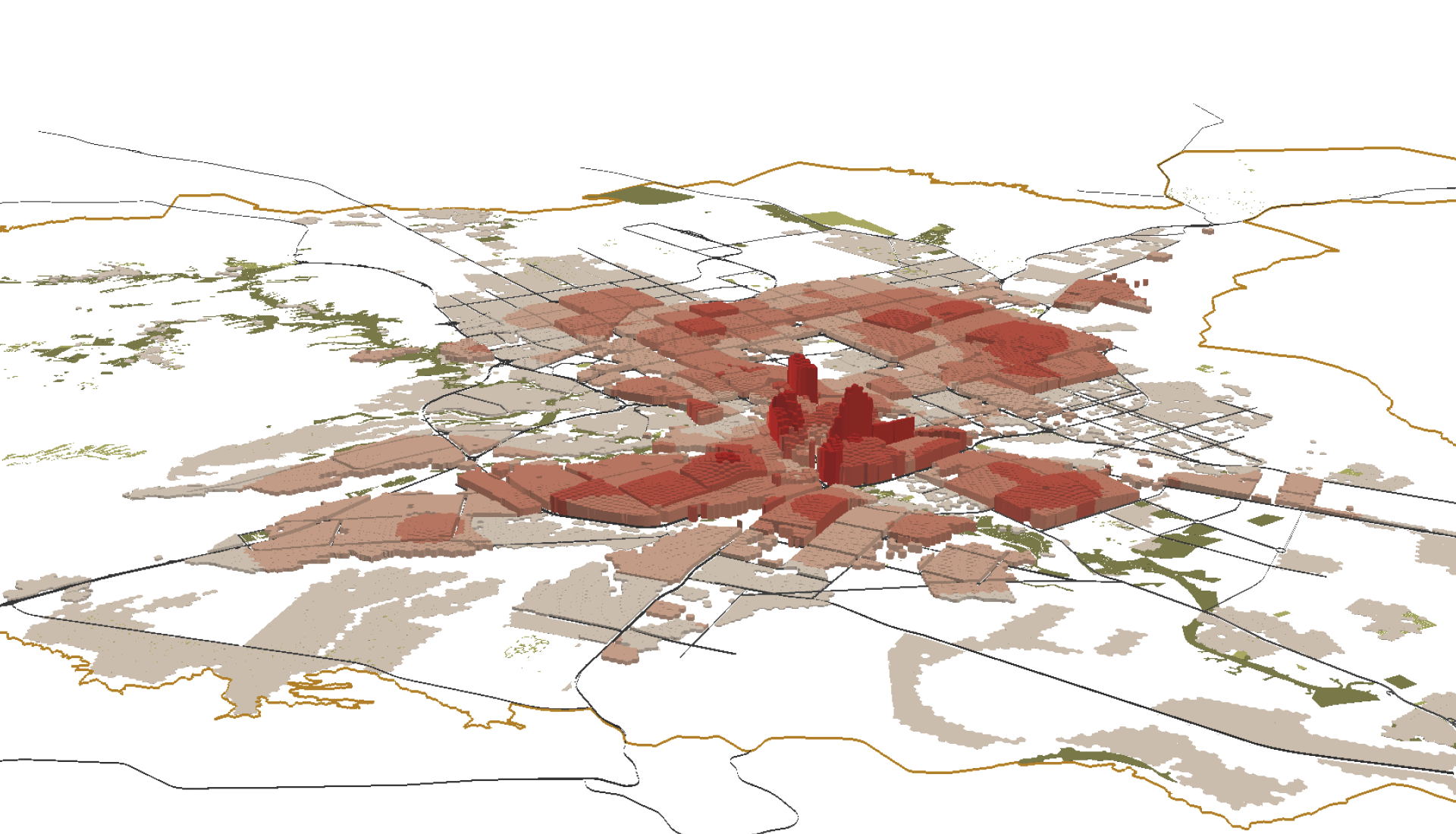
Spatial Plan for Nine Cities
of Sharjah Emirate 2040
Trend Approach using a Land-Use Constraint Model
One of the main aspects of Sharjah’s Spatial Plan covered the
mapping of existing and projected land uses, including residential,
commercial and industrial areas, as well as sensitive areas which
should be protected from future urban development. On this basis, it
was possible to create, for the first time in Sharjah Emirate, an
optimal tool for sustainable land management.
A Land use constraint model was built to allocate highly sensitive
areas including agricultural lands, natural green open spaces and
natural habitat zones, archaeological and heritage protected zones,
and water resources.
This model was highly efficient to allocate available free areas for
new developments by extracting actual built-up areas, committed
areas and land having physical constraints like mountains and Wadis.
|