
 ← Back to All Projects
National Aerial Mapping and 3D City Modeling in Qatar
National aerial mapping helps Qatar’s public authorities plan infrastructure and respond to changes in the country’s cities and landscape. The Centre for Geographic Information Systems (CGIS), under the Ministry of Municipality, partnered with Khatib & Alami (K&A) to modernize how the geospatial products are captured, produced and shared.
The project combined airborne imaging, digital mapping, 3D city modeling and enterprise GIS. Alongside the mapping products, it established the technology, workflows and technical skills CGIS needs to manage future updates with greater independence.
Modernizing national geospatial infrastructure

As Qatar’s cities and infrastructure continue to develop, geospatial data must be updated regularly. Dependence on external data production and fragmented workflows made a more connected production environment a priority for CGIS.
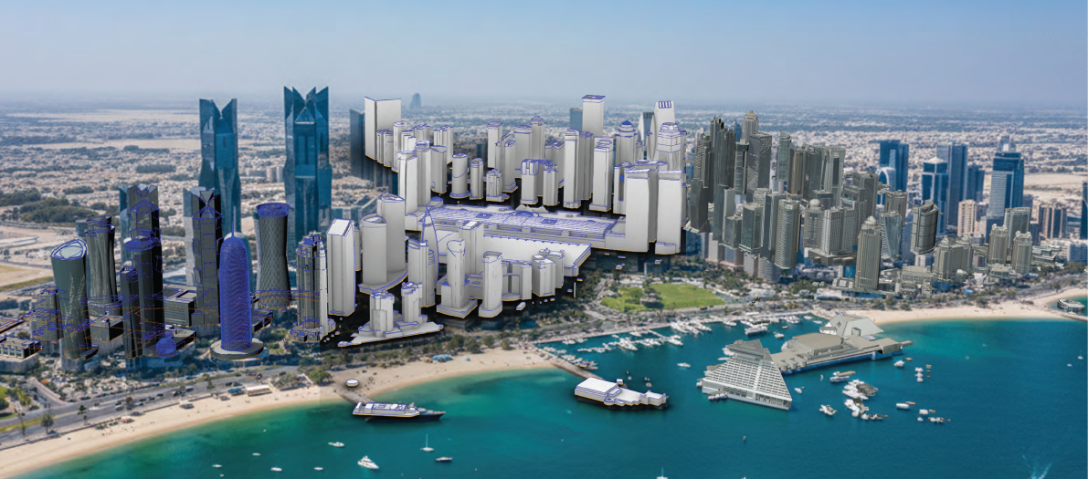
The project strengthened CGIS’s ability to capture, process and maintain authoritative spatial information. Nationwide aerial mapping supported updates to national topographic information, while detailed imagery over Doha and other priority urban areas provided the basis for 3D building models and urban visualization.
Connecting aerial mapping with digital innovation
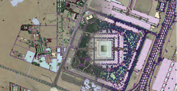 The team integrated specialized airborne surveying systems with photogrammetric processing and vector mapping tools to produce maps and models from aerial photography. Enterprise GIS platforms handle the publishing and delivery of the resulting data.
Outputs include high-resolution orthophotos, topographic maps, elevation data and textured 3D city models. Automated processing and standardized quality checks helped produce more consistent results, including when converting models and publishing datasets.
Users can explore the information through interactive mapping and 3D viewing applications for planning, engineering and infrastructure coordination.
Creating long-term value for Qatar
Through knowledge transfer and technology integration, CGIS can maintain current geographic information and respond to new mapping requirements with less reliance on external production.
More than 100 government entities benefit from improved geospatial data accuracy, accessibility and efficiency. Users include the Ministry of Municipality, Ashghal (Public Works Authority), Kahramaa, the Ministry of Environment and Climate Change and the Ministry of Interior. Qatar Rail, municipal bodies and academic institutions also use the information.
These datasets support urban planning, infrastructure development and environmental assessment. Producing and updating them within CGIS also provides a foundation for future digital twin and smart city initiatives, supporting Qatar National Vision 2030.